The early morning light hits the limestone in pale gold. The forest is quiet. And somewhere above you, hidden behind a curtain of rock and ridge, the highest point you are legally allowed to reach on all of Mallorca is waiting. Most people on the island have never climbed it. Most have never even heard of it. But Penyal des Migdia, rising to just forty meters below the radar-topped summit of Puig Major, is as wild and as rewarding as Mallorcan hiking gets.
This is not a hike you do on impulse. The route crosses private land, actively farmed, grazed, and hunted like most of the Serra de Tramuntana. You need a permit to take the most beautiful route. You need to respect the hunting calendar. And most importantly, you need a guide who actually belongs here.
Why You Need a Local Guide for this Hike
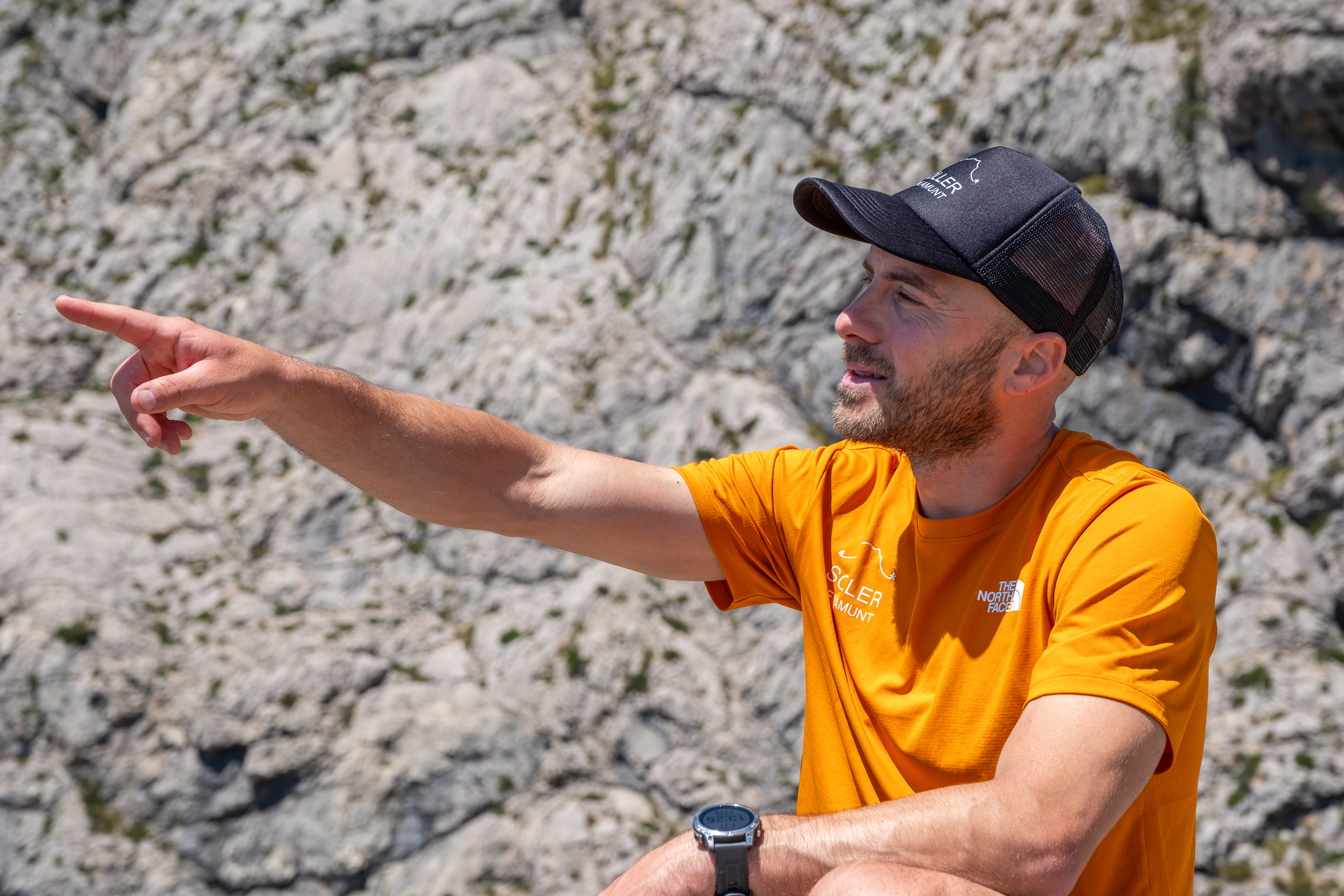
Andreu Borràs grew up in Sóller, at the foot of these mountains, and has spent over a decade building something that no qualification alone can give you: trust. Trust with the families who own this land. Access through gates that stay locked for everyone else. And a knowledge of routes that only comes from years of hiking them in every season. “Many people underestimate hiking in Mallorca,” he says. “Above eight hundred meters it becomes genuinely alpine.” He is not exaggerating.
From the Forest to the Rockface
The hike starts near the Monnaber tunnel, where holm oaks filter the early light into patches of warmth and shadow. Soon the path leads through a private finca and the landscape begins to shift. The trail pushes through tall esparto grass and overgrown stones. Andreu stops to point out a small Mallorcan cyclamen flowering between two boulders. Then the tree cover thins, the scree field opens ahead, and you leave the tree line behind.
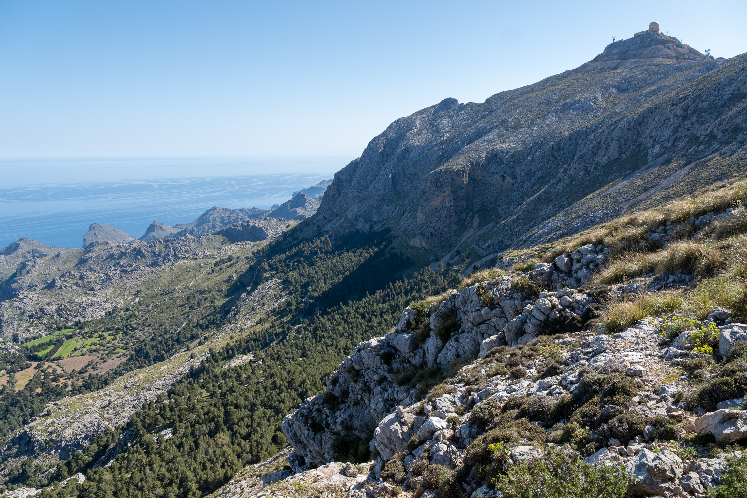
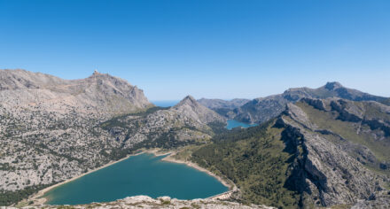
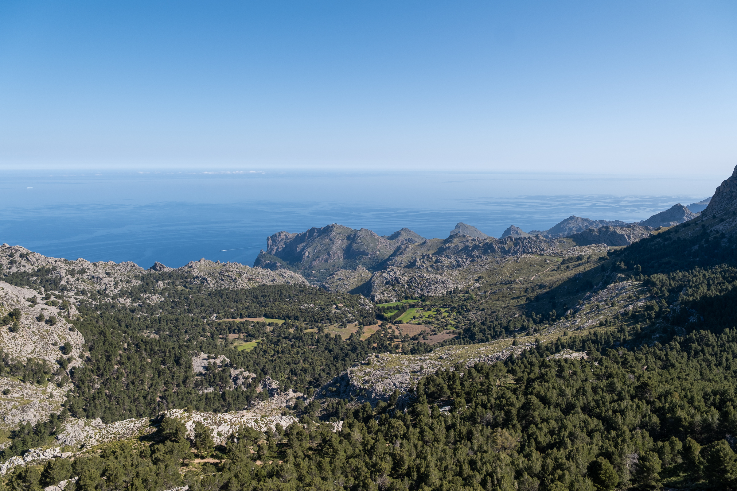
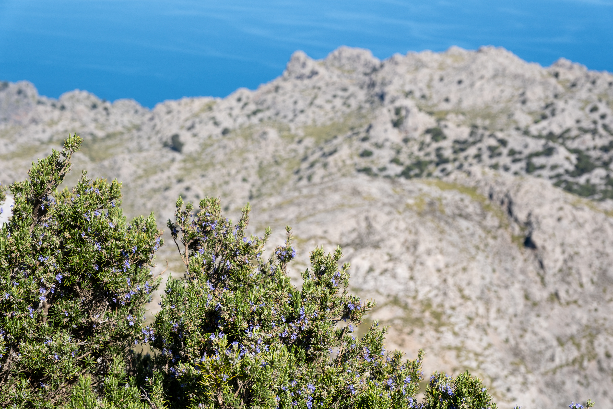
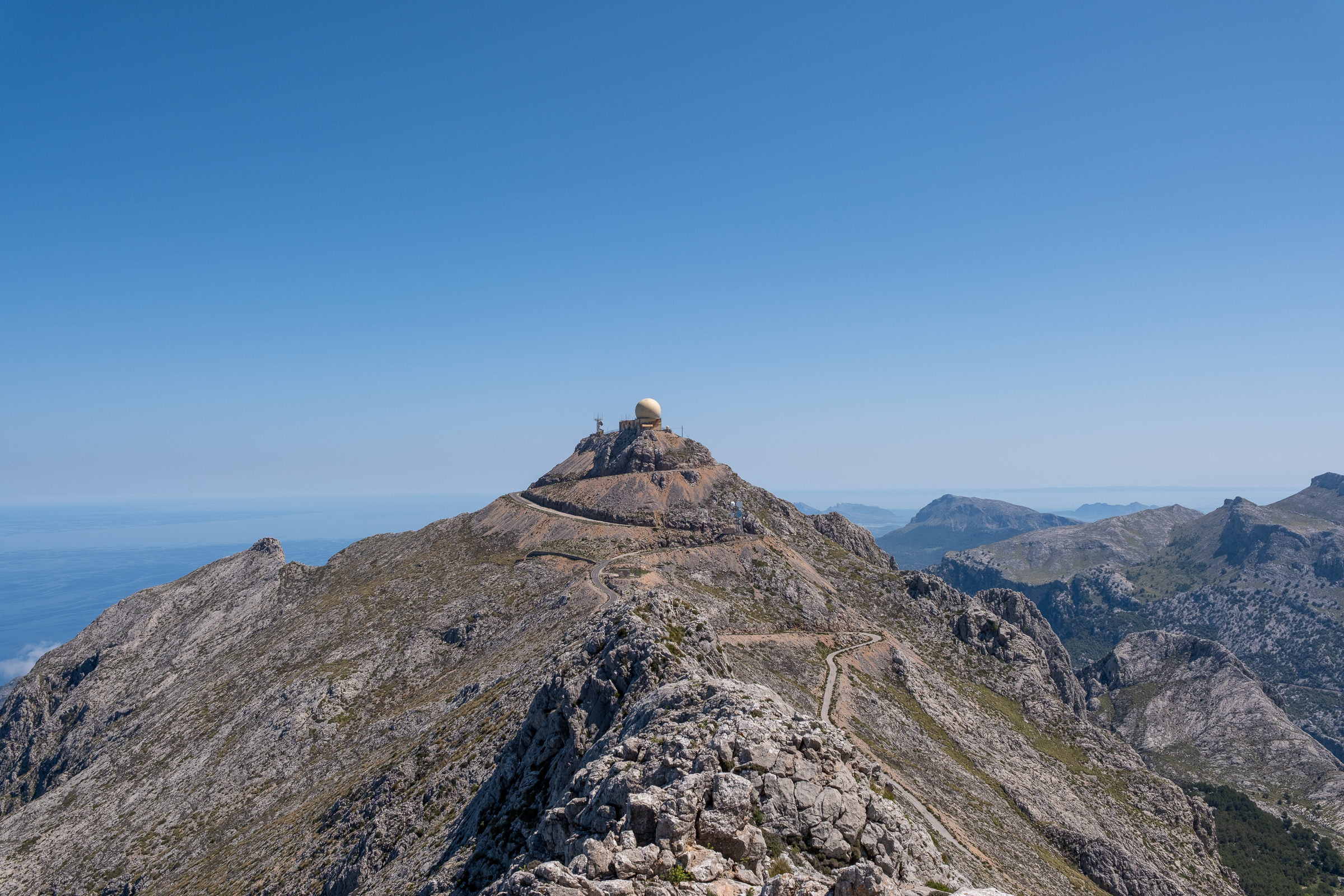
From here on, the radar sphere of Puig Major keeps watch above you. And the broad green valley of Bini Gran stretches out in perfect silence. No roads. No engines. Just birdsong, the occasional bleat of a sheep or goat moving across the slope, and the smell of rosemary. Enormous bushes in full blue flower line the path from base to summit and back again, releasing their fragrance with every brush of a passing boot. It stays with you the entire day.
Into the Alpine Zone: Mallorca Surprises You Here
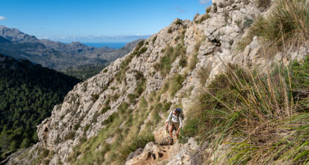
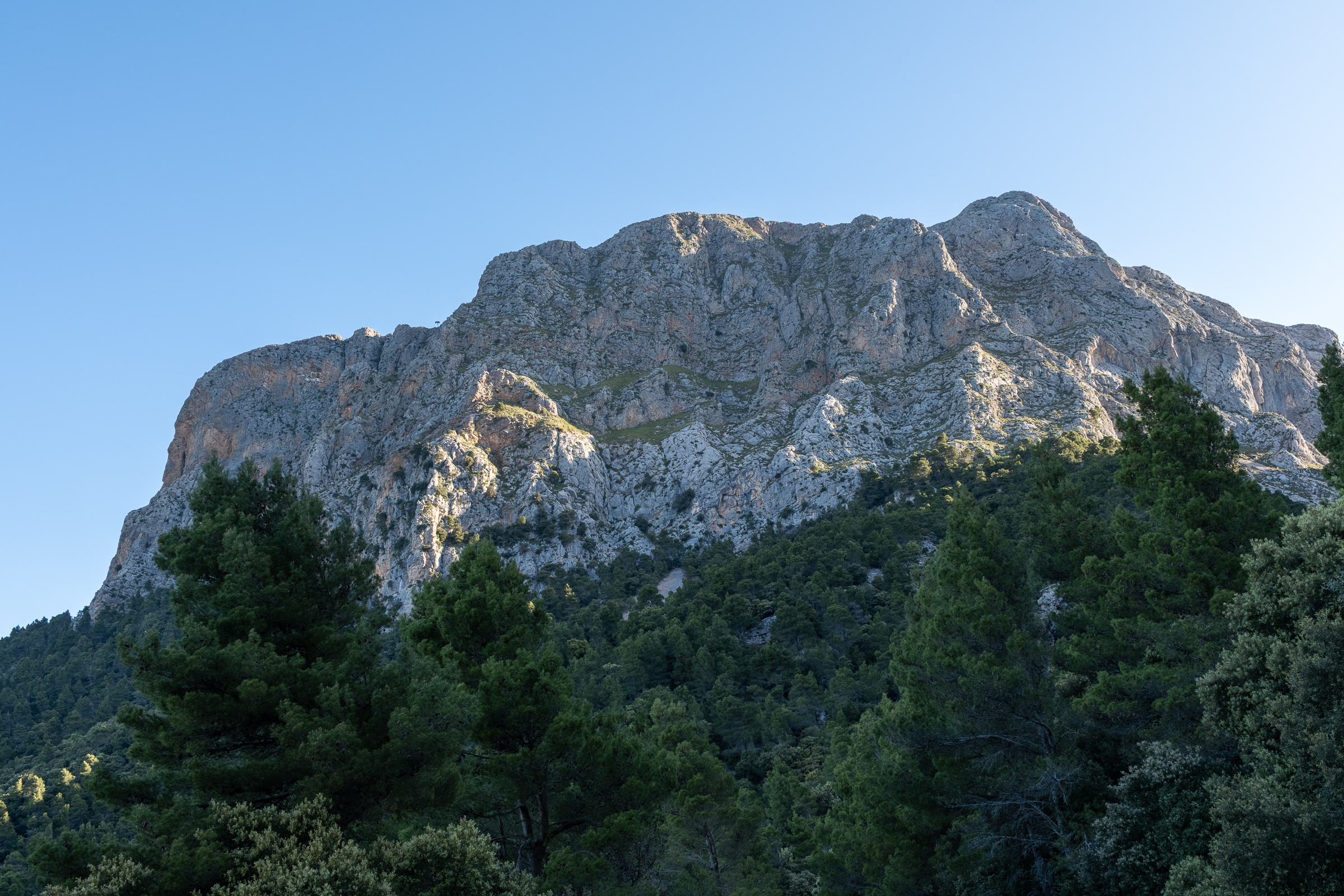
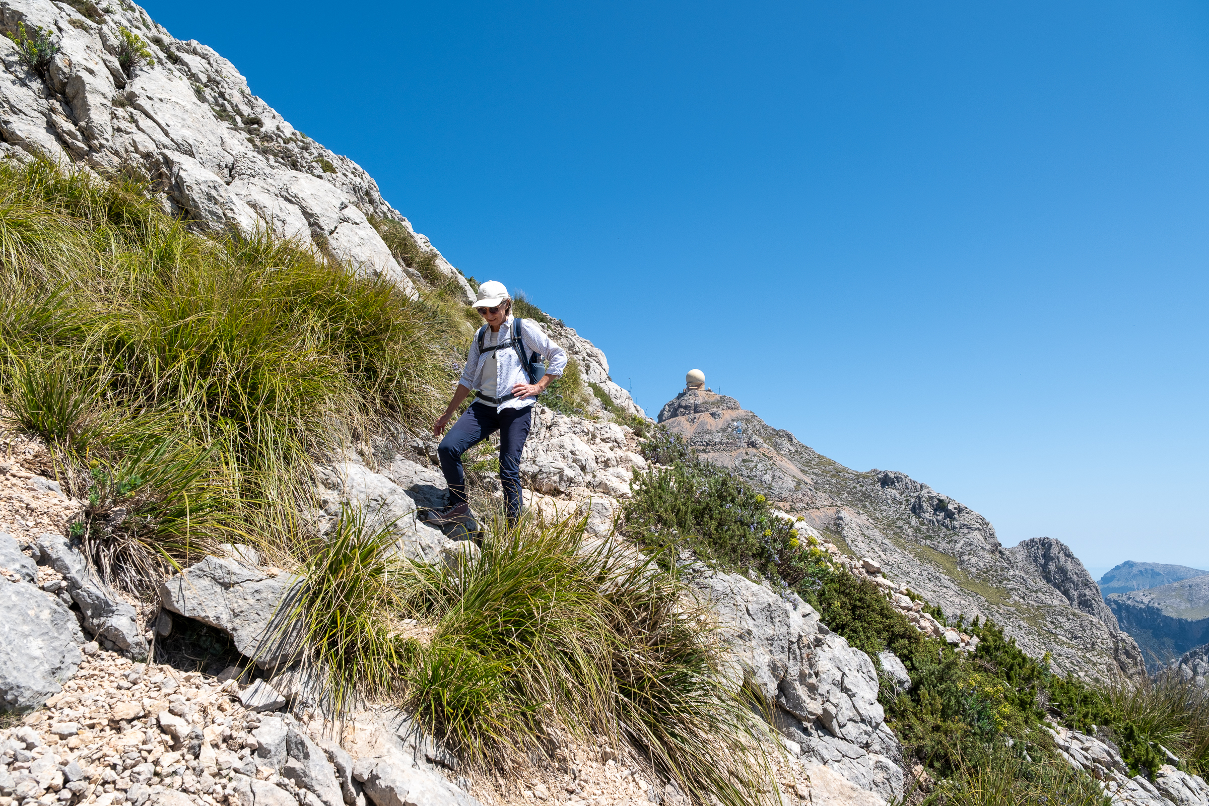
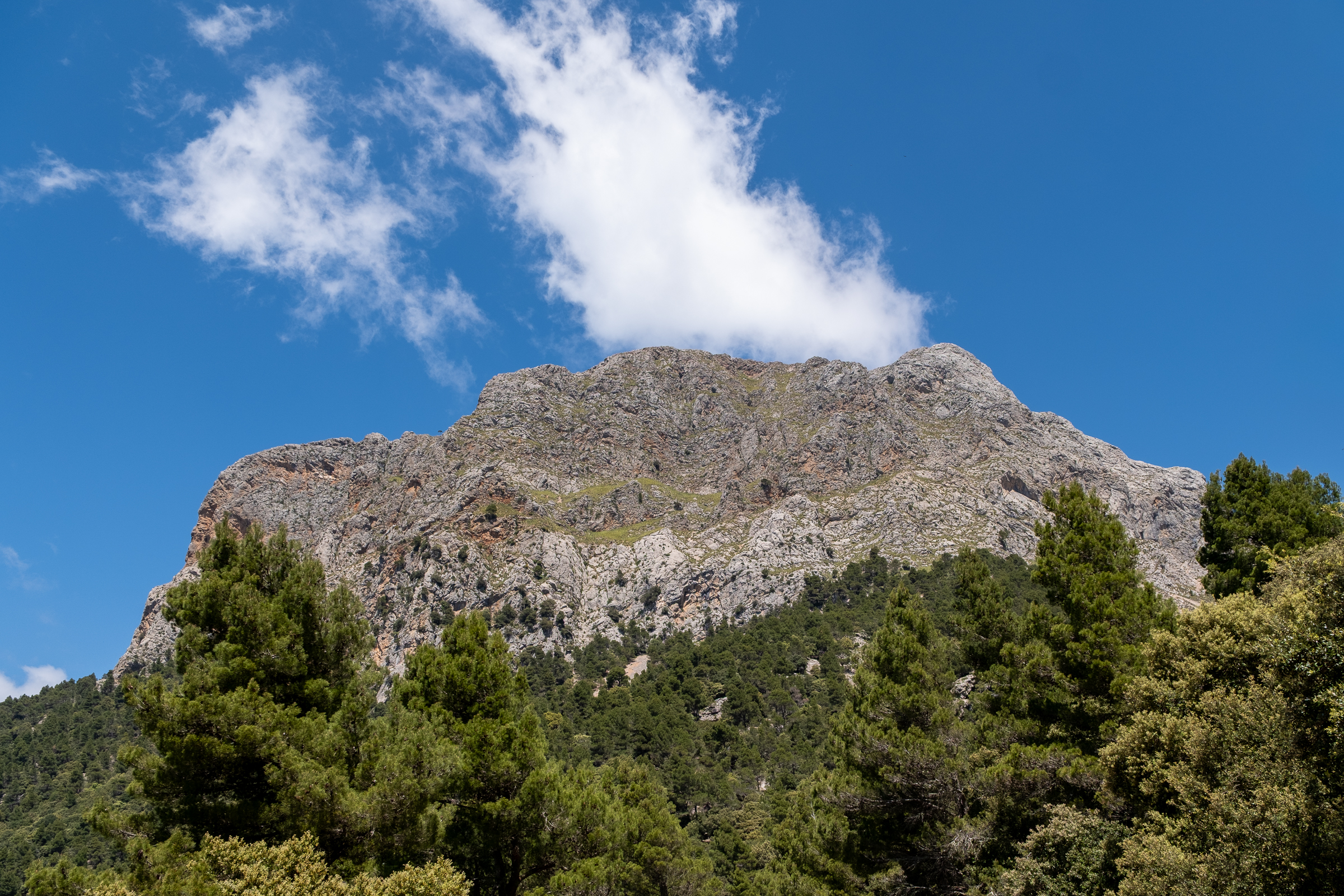
Higher up, the route narrows and steepens sharply. Andreu identifies the endemic St. John’s wort growing along the ridge. The path presses close to the cliff face, now. There are sections where you use both hands and feet, finding holds in the limestone, pulling yourself upward one careful move at a time. The views crack open suddenly and without warning. Torre Picada appears. Then Tuent, even Lluc in the distance.
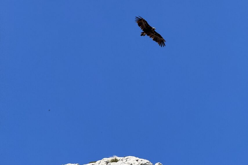
Look up, and chances are good you will spot the broad, motionless silhouettes of griffon vultures riding the thermals overhead. Get lucky and you might also catch the darker, fringed wings of a monk vulture, one of Europe’s largest raptors and a long-established resident of these mountains. The griffons are relative newcomers. Blown across from the mainland just a few years ago on extraordinarily strong winds, they liked what they found and never left. Up here on the ridge, with both species carving slow circles above you against an open sky, it is hard not to feel like you are sharing the mountain with its rightful kings.
But the trail also runs directly along the drop-off in places, with nothing between you and a very long fall. Absolute sure-footedness is required. A good head for heights is not optional. This is not a route for first-time hikers or anyone who hesitates on exposed ground. For those who are ready, though, every step forward is a step into a world most visitors to Mallorca will never see.
The Ridge Walk: Mallorca’s Highest Legal Summit
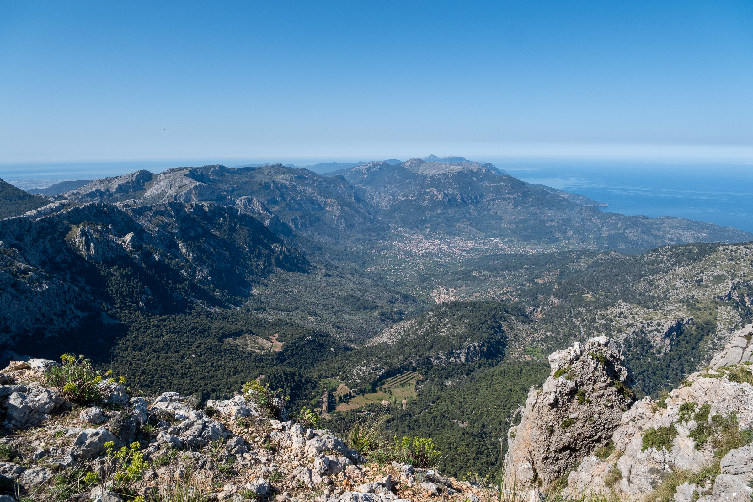
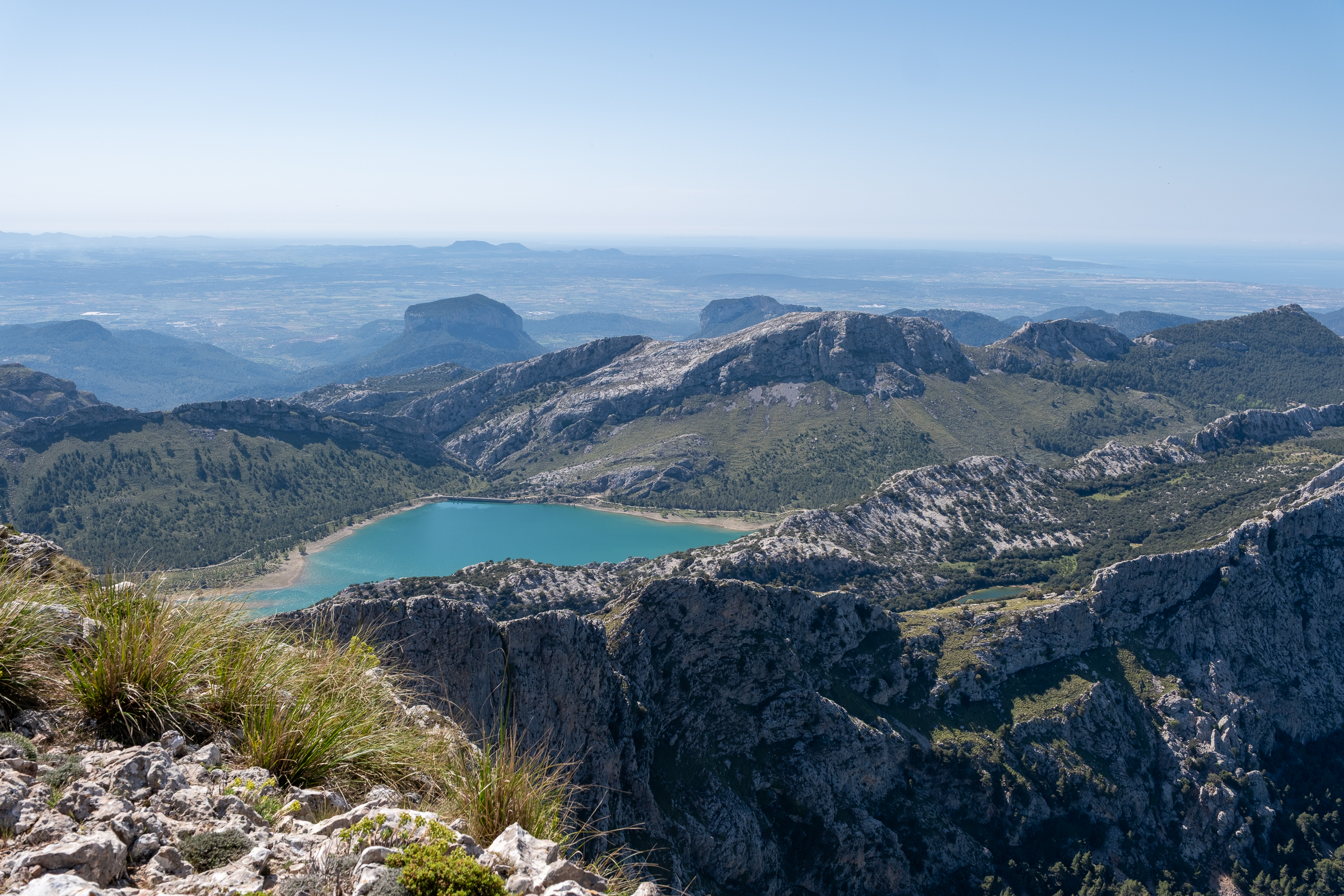
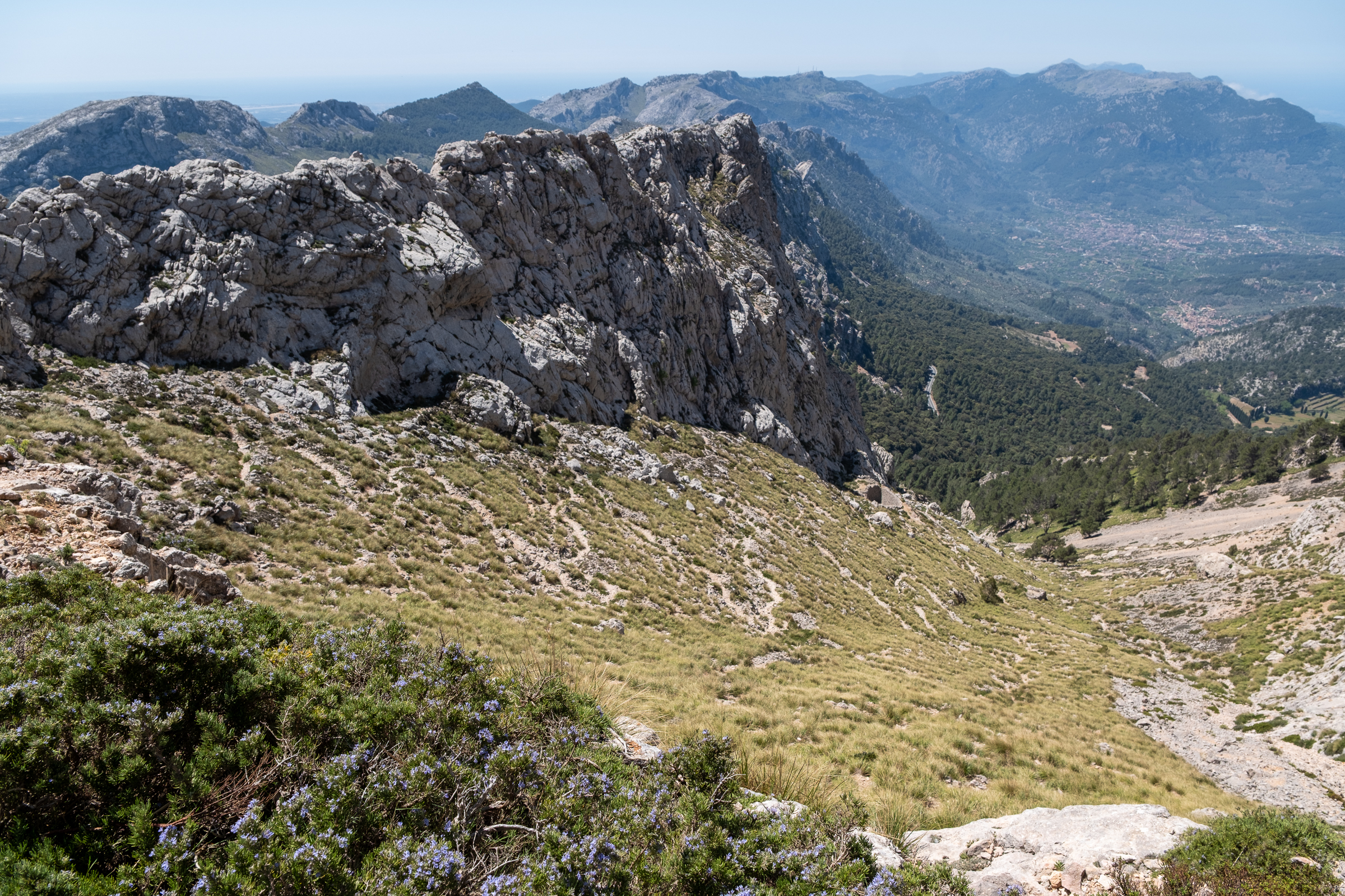
Just below the final push to the top, the panorama cracks open to the south. The bulk of Galatzó appears on the horizon. The Sóller valley spreads wide and luminous below. The Bay of Palma curves in a long silver arc. The reservoir of Cúber shines like hammered metal in the midday light.
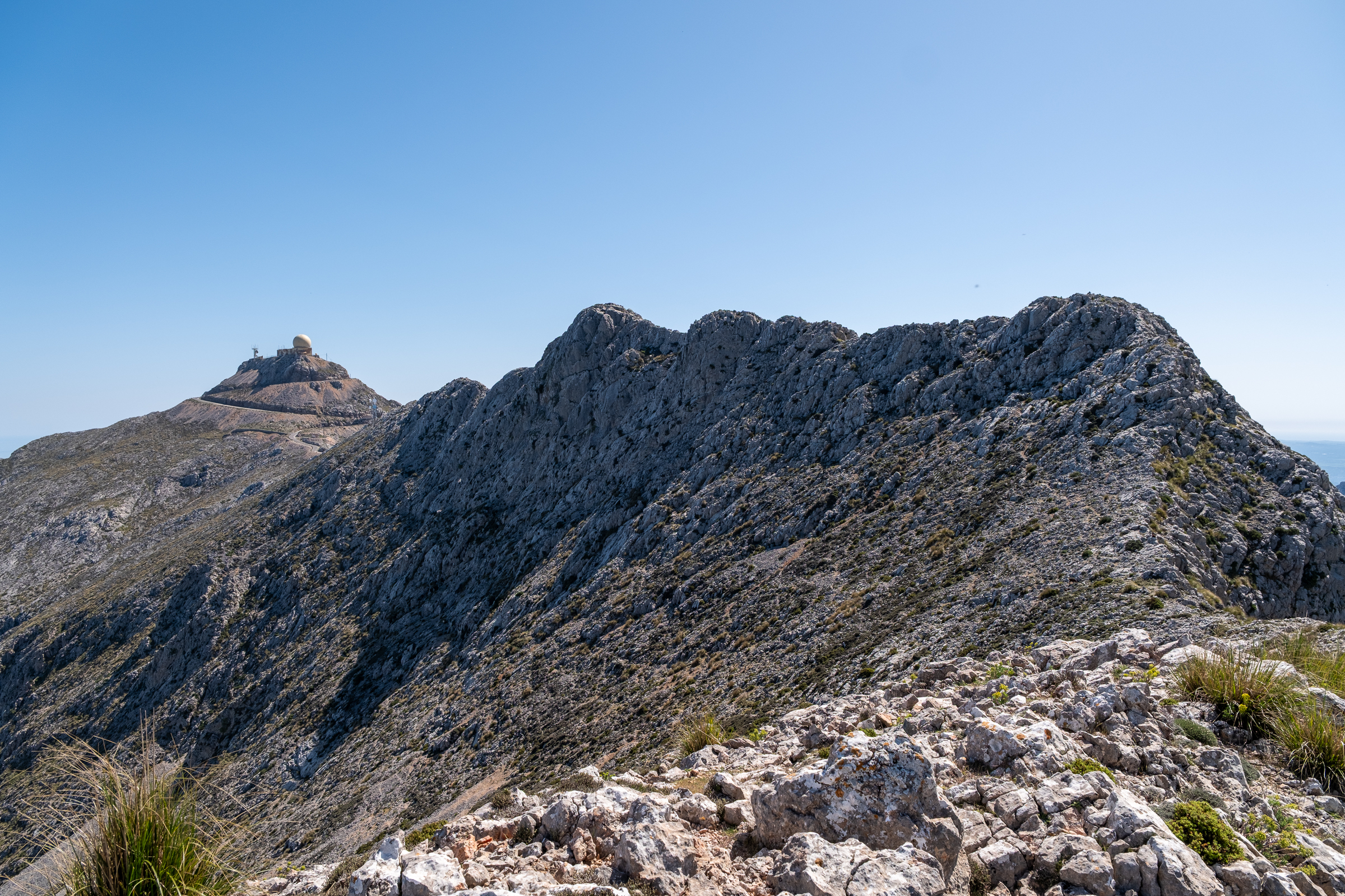
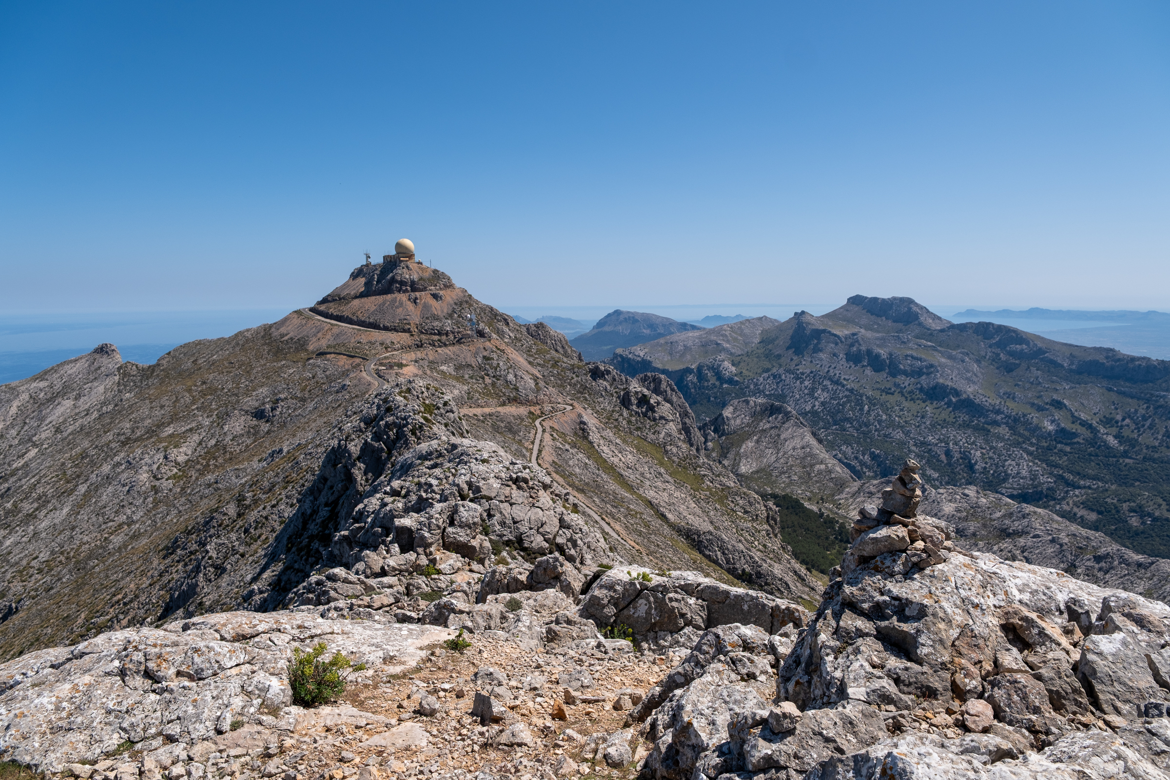
Then the path finds the cresta, the narrow ridge that leads to the summit itself. Puig Major feels close enough to touch. And here is something most people do not know: Penyal des Migdia is not a single peak but a series of summits, each one slightly higher than the last, each one climbed in turn along the ridge. The highest sits just forty meters below Puig Major. And since that summit is a military installation and permanently off-limits, Penyal des Migdia is the highest point any hiker can legally stand on in all of Mallorca.
From the top, the full northern Tramuntana spreads in every direction. Massanella. Tomir. The bays of Alcúdia and Pollença reaching toward the sea. The long finger of Formentor pointing northeast. And on the clearest days, faint and floating on the horizon, the outline of Menorca.
The Descent Through History
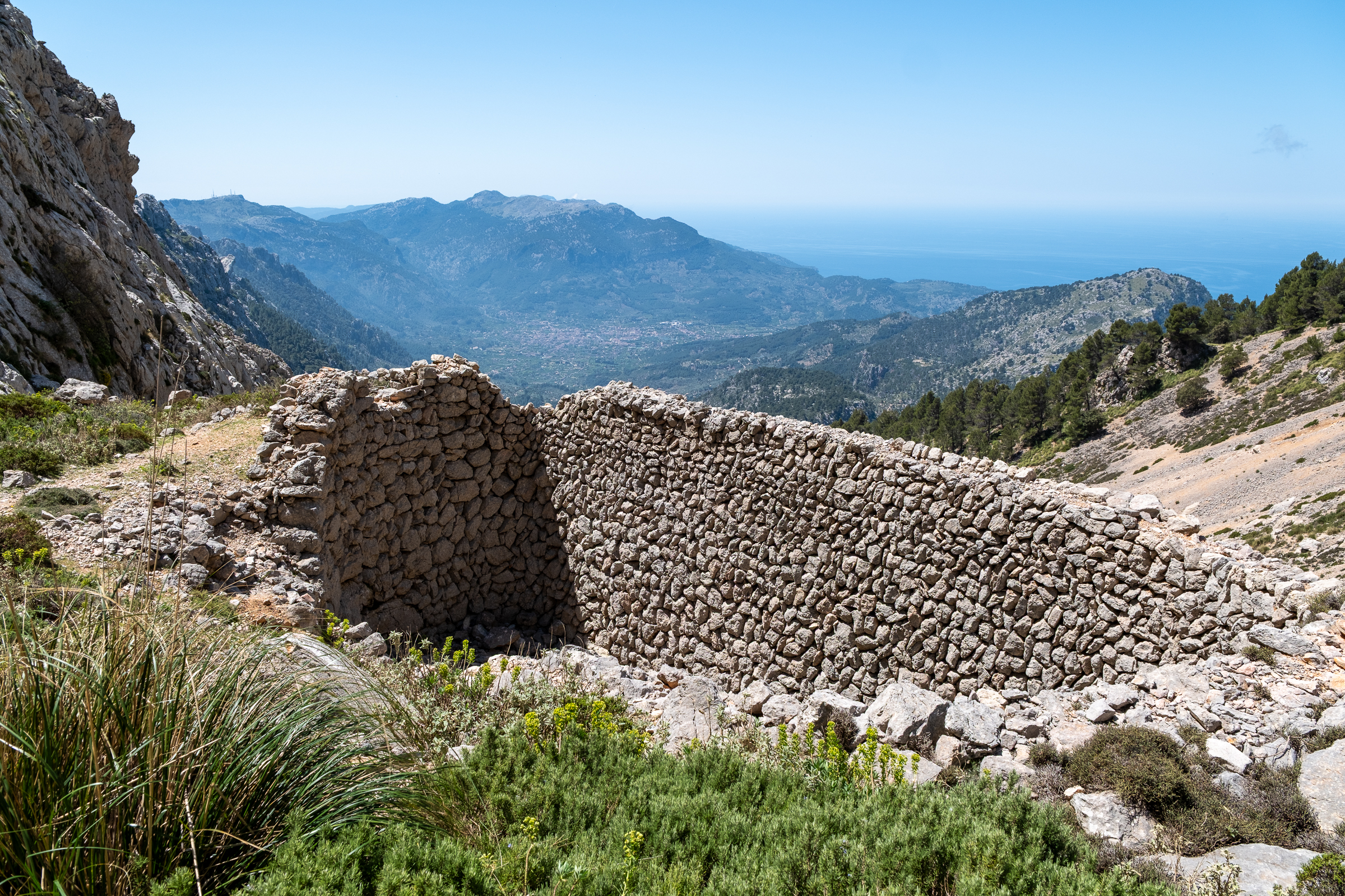
The first section of the descent is steep, hugging the wall of the mountain. Then the route picks up an old camí de neu, a snow collector’s path that winds back down in long, careful serpentines. Along the way, the stone shells of cases de neu begin to appear.
These snow houses were built in the early eighteenth century for the collectors who spent their winters up here packing snow into ice, compressing it layer by layer with salt and ash and leaves, then waiting. Come June, they loaded the ice onto donkeys and walked it down to the towns below. Not for ice cream. But for medicine, for preserving food, for cooling fever. The mountains that feel so wild and remote today were once someone’s workplace, and someone’s winter.
Back Through the Holm Oaks: The Closing Circle
Further down, the camí de neu delivers you back into the holm oak forest. The light softens into half-shade. The gradient eases. The path widens. And gradually, almost gently, the route loops back to the starting point near the Monnaber tunnel.
Behind you, the ridge line of Penyal des Migdia catches the warm afternoon sun. You have crossed private land through a permitted gate. You have walked a path most visitors never find. And you have stood, briefly, at the top of the island.
What You Need to Know
The hike to Penyal des Migdia is rather challenging. Sure-footedness and a head for heights are essential. The route crosses private farmland where hunting is active, always observe current signposting. We strongly recommend that you do not take this tour without a local guide. ![]()
Duration & Elevation: distance 7.5 km, duration 4 to 4.5 hours, elevation gain 650 m
Read more about hiking in the Serra de Tramuntana, here.